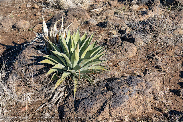
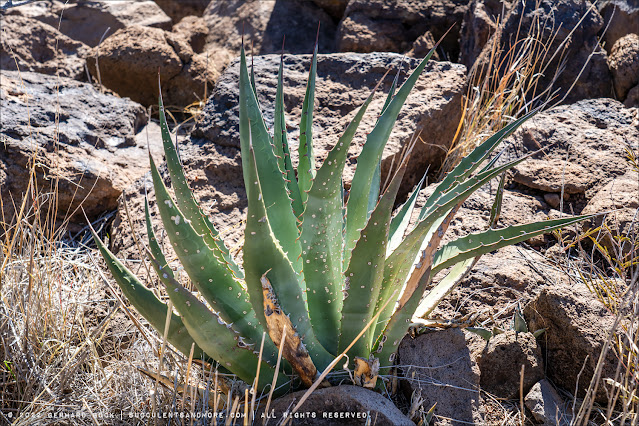
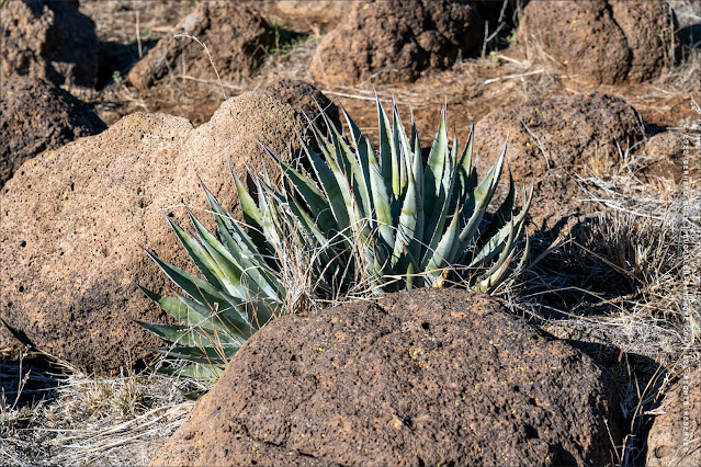
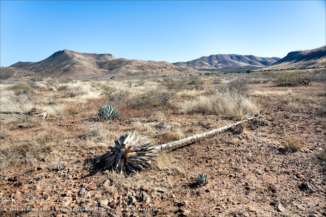
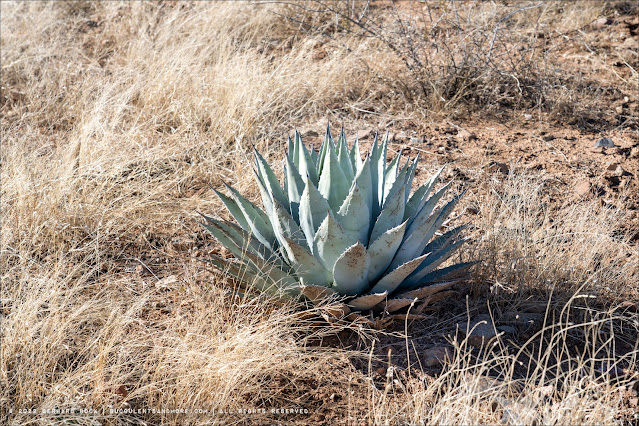
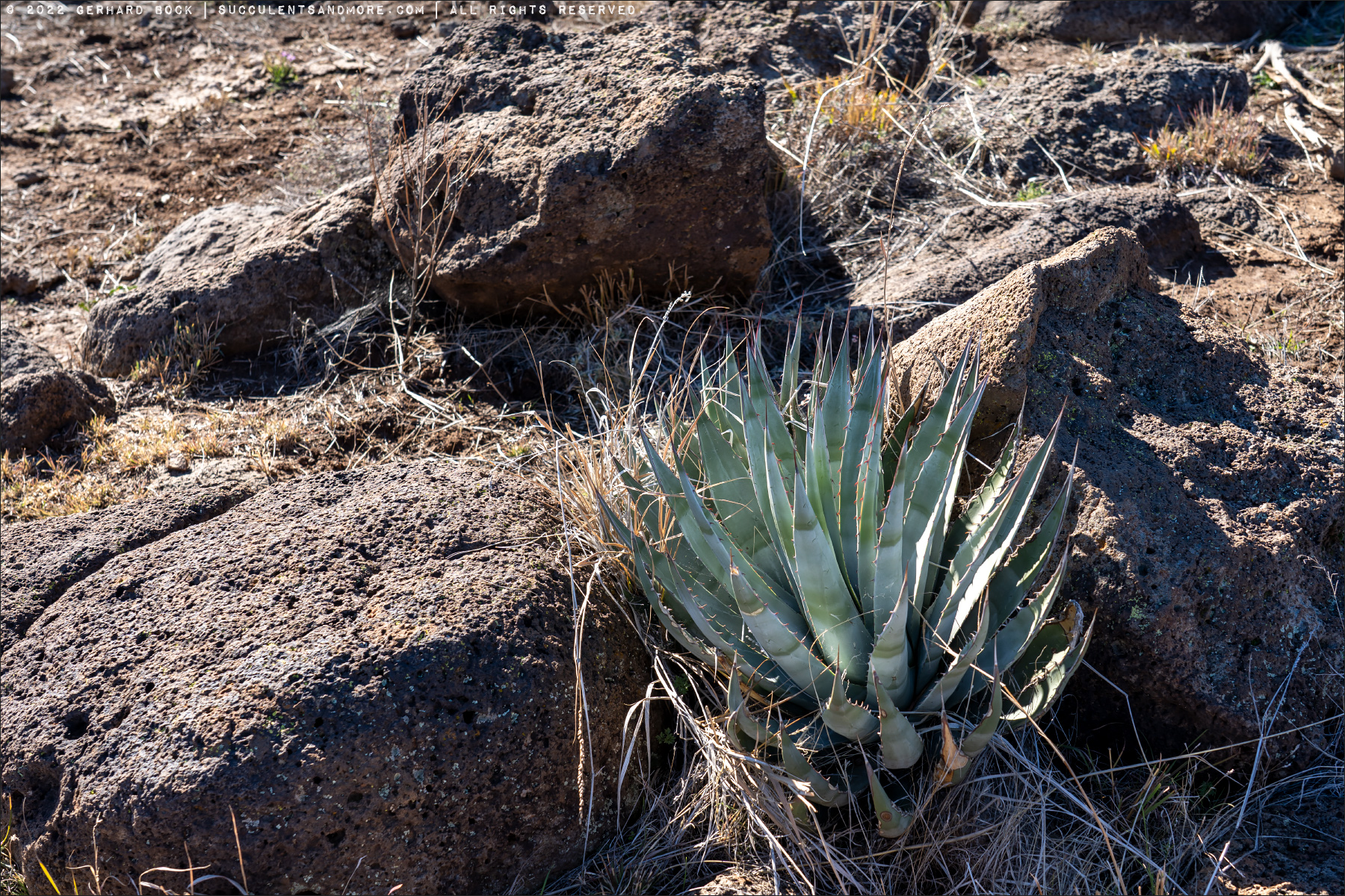
The most common agave at Agua Fria is
Agave aff. chrysantha, although it’s mostly found as isolated specimens rather than dense populations. Based on Ron’s suggestion, I’m referring to it as aff. (affinis)
chrysantha, because it has a close affinity with
chrysantha although it may be a hybrid or something else that hasn’t been described yet.
Agave chrysantha is native to a wide swath of central Arizona and quite variable in appearance and size. Ron has found
A. chrysantha specimens as large as 8 feet in the Pinal Mountains southeast of Phoenix, but the plants we saw at Agua Fria were no more than 2 feet in diameter. Much more research, especially genetic analysis, is needed to untangle the
Agave chrysantha complex.
 |
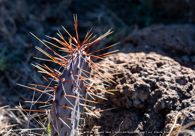
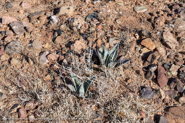
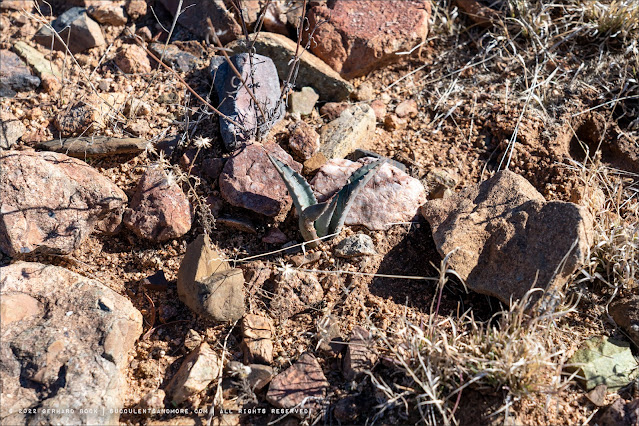
| Agave aff. chrysantha |
 |
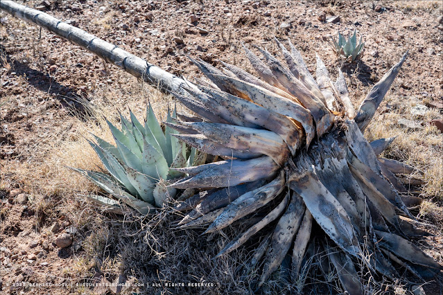
| Agave aff. chrysantha with damage from running bugs (Caulotops barberi) |
 |
| Agave aff. chrysantha |
 |
| Agave aff. chrysantha |
 |
| Agave aff. chrysantha |
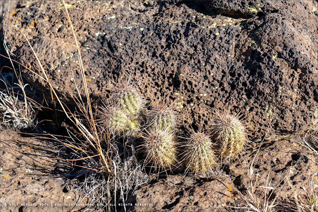
In terms of cacti, we encountered quite a variety, including Escobaria vivipara, Echinocereus engelmannii, Opuntia engelmannii, Opuntia phaeacantha, Cylindropuntia acanthocarpa, and Cylindropuntia whipplei:
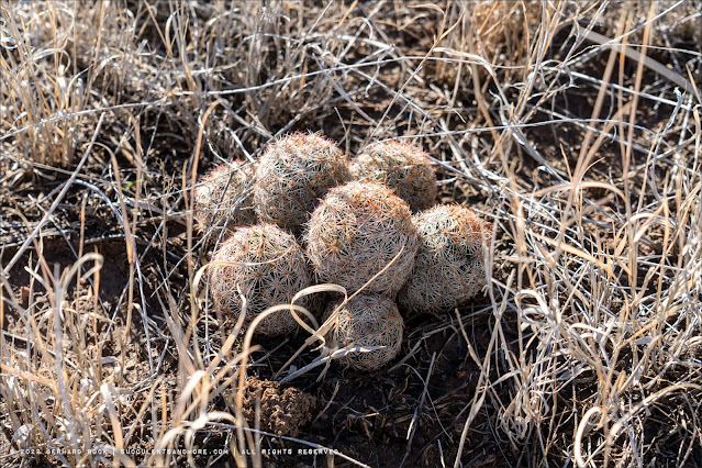 |
| Escobaria vivipara |
 |
| Echinocereus engelmannii |
 |
| Echinocereus engelmannii |
 |
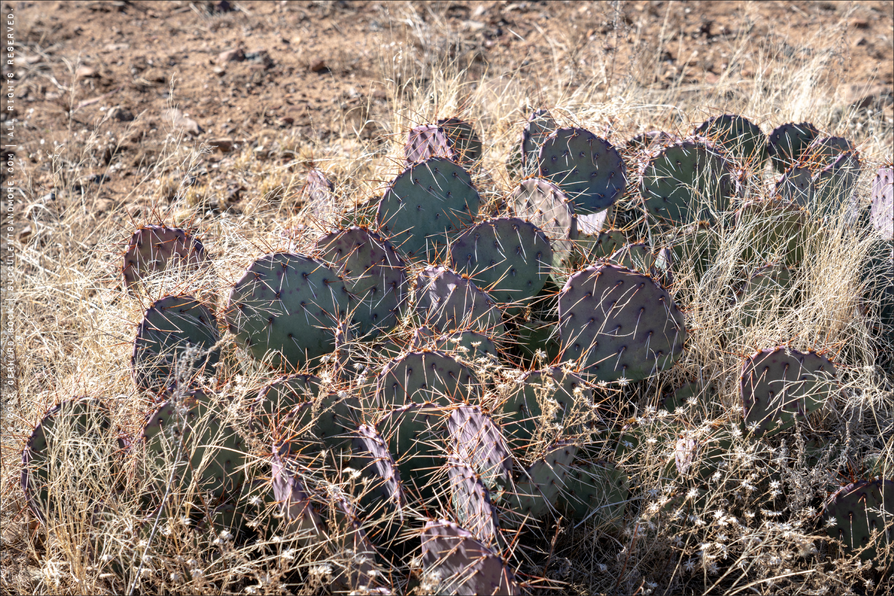
| Opuntia engelmannii |
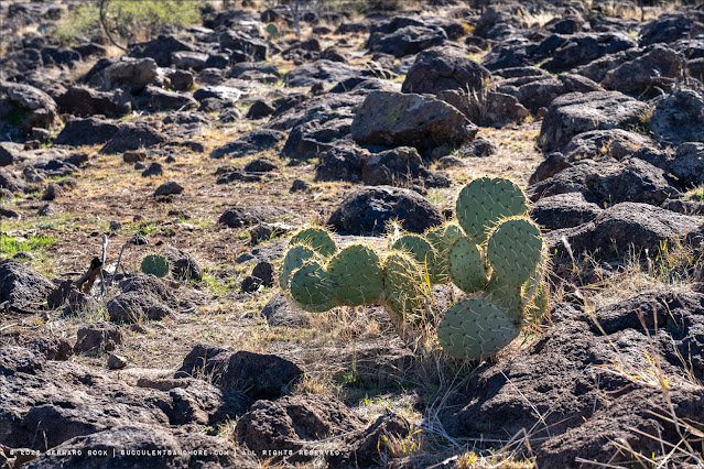 |
| Opuntia engelmannii |
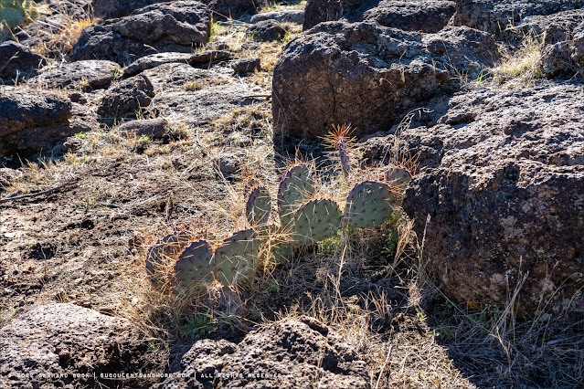 |
| Opuntia phaeacantha |
 |
| Opuntia phaeacantha |
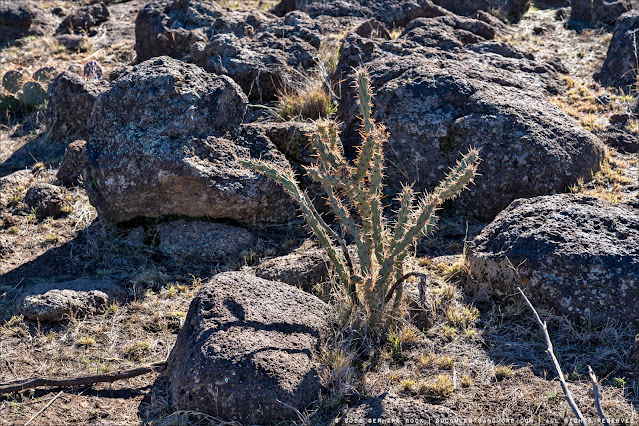 |
Cylindropuntia acanthocarpa
|
 |
Cylindropuntia whipplei
|
The agaves and cacti we encountered may not have been the most photogenic specimens of their kind, but seeing them in their natural environment is such a thrill for me. After a while, Ron started to tease me for stopping so much to take photos of plants he thought were completely ordinary. Except to me, even an ordinary agave or cactus in habitat is extraordinary.
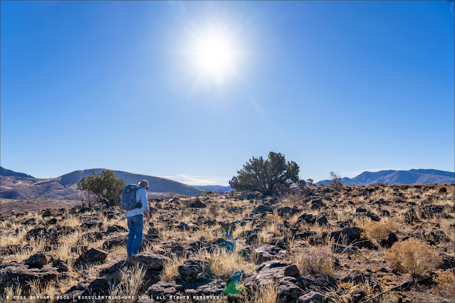 |
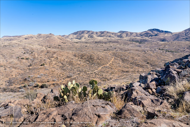
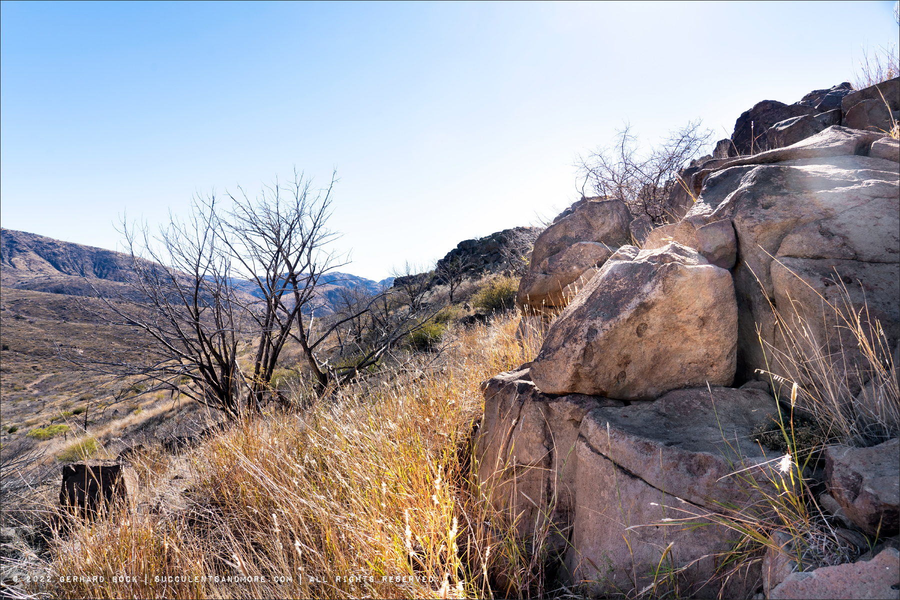
| Ron walking across the rock-strewn grassland on Perry Mesa |
Our destination was a remote site on Perry Mesa that had once been home to a poorly understood group of people now known as the “Perry Mesa Tradition.” Archeologists still don’t know the identity, origin, or ultimate destiny of the Perry Mesa people, but they lived on this windswept plateau from approximately 1250 to 1450 CE and left behind stone ruins and, even more remarkably, hundreds upon hundreds of petroglyphs.
The ruins at the complex we visited—essentially collapsed rock walls that had once formed room blocks—were very hard to photograph so I didn’t even try. Compared to elsewhere, they are not well preserved. To give you an idea of what the ruins look like, here is a photo from Ron:
 |
| Collapsed rock walls that had once formed room blocks |
But there is plenty of other evidence of the Perry Mesa Tradition that is far more impressive:
In the spot you see in the photo above and the three photos below, there are dozens of hollows in the rocks. They’re easy to see in these pictures because they’re filled with water from a recent storm. These depressions are metates carved out of the bedrock. They were used to grind grains and seeds, primarily corn, by means of a handstone called a mano.
It felt decidedly odd to be standing on this vast and silent plateau, contemplating the remains of a civilization that had existed here so long ago. There was nobody else around, just Ron and me, and there were no man-made sounds, just the soft whistle of the wind.
 |
| Metate field |
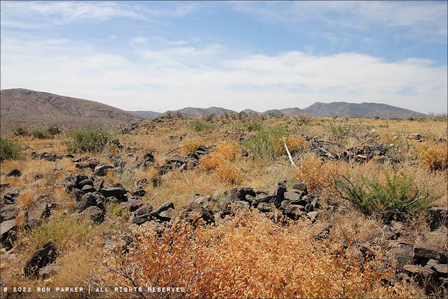
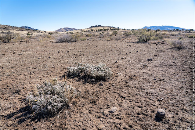
The site we visited is at the edge of a plateau which drops down into a fairly wide valley bounded by rolling hills beyond.
The petroglyphs we were here to see are pecked into the cliff face. In the photo above, you can see how sheer the cliff is.
Getting to the petroglyphs involves a fair amount of scrambling over rocks, trying to avoid loose boulders that might shift as well as the occasional catclaw acacia (Senegalia greggii) that seems only too eager to grab your clothing and skin. Fortunately, Ron had done this kind of climbing many times before and expertly led the way.
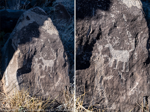
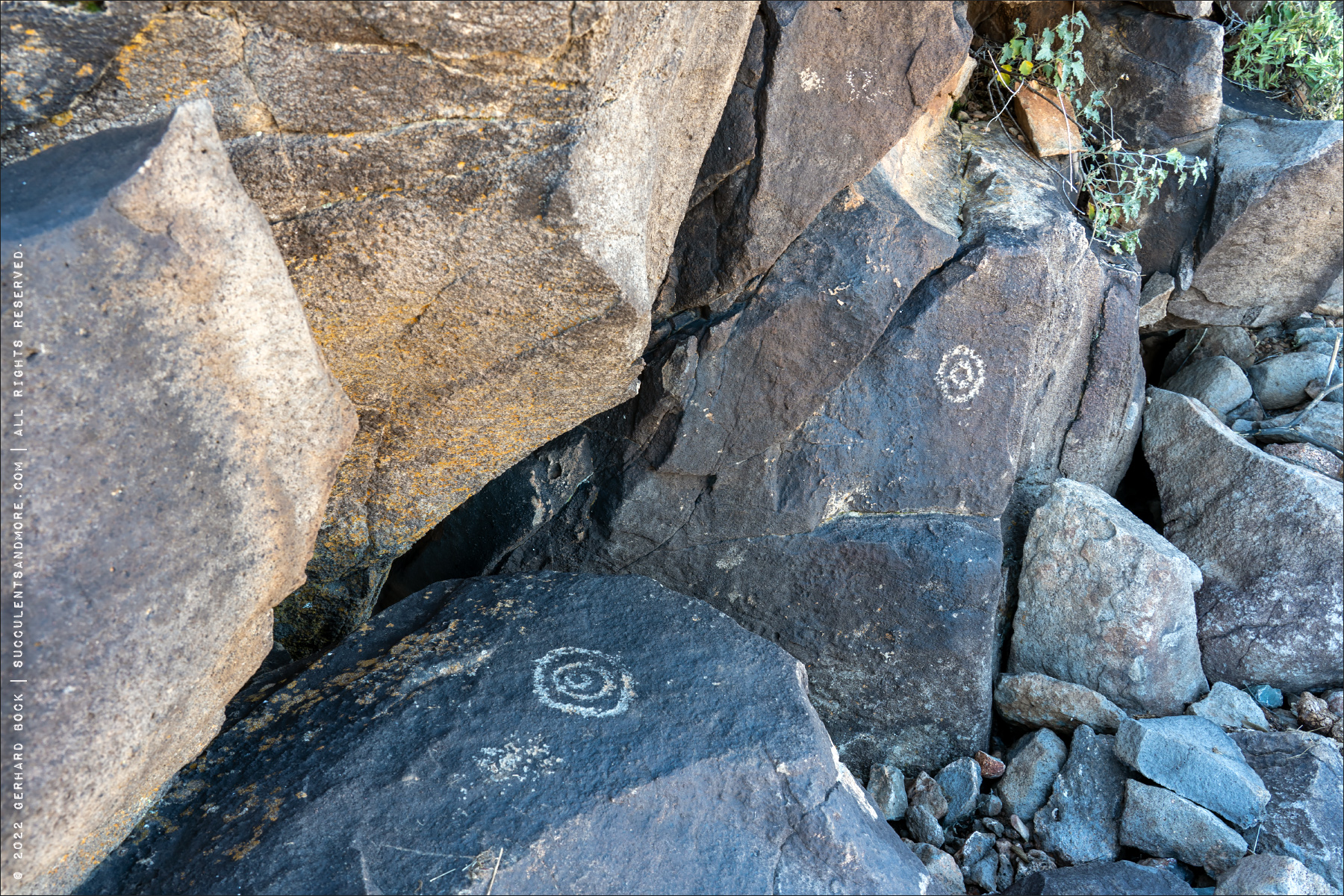
The most enduring legacy of the people of the Perry Mesa Tradition are the countless petroglyphs pecked into rocks and cliff faces throughout Perry Mesa. Some of the petroglyphs we saw were clustered in massive panels:
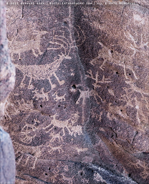 |
| Animals, mostly deer and antelopes |
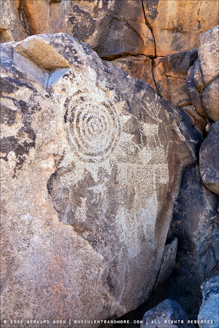
Petroglyphs generally fall into three categories based on what they show: zoomorphs (animals), anthropomorphs (people), and abstract/geometric shapes.
Animals are the easiest to understand, seeing how hunting played a major role in the lives of the Perry Mesa people.
People are often depicted with broad shoulders, exaggerated hands, or giant headdresses; the latter are probably shamans.
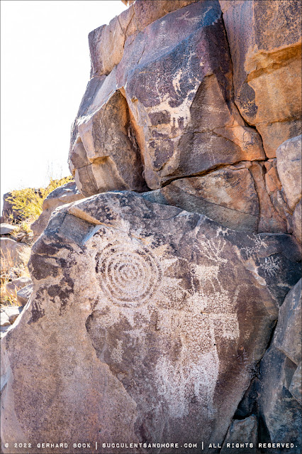
Geometric shapes include circles (often concentric) and all manner of symbols and unidentified objects. Somewhere else in Agua Fria National Monument is a
spectacular petroglyph that may depict the night sky during the
Supernova of the year 1054. If that’s the case, the petroglyph would predate the Perry Mesa Tradition (1250-1450).
 |
| Antrophomorph with giant headdress |
 |
| Simple concentric circles |
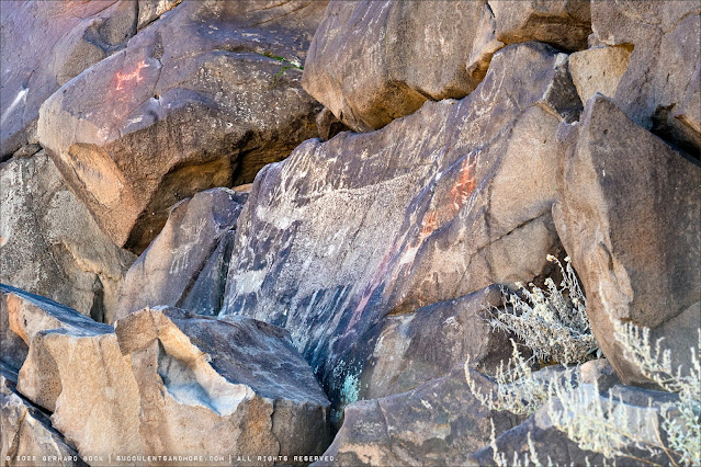
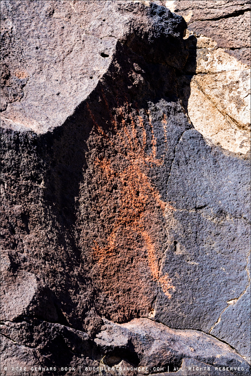
Some petroglyphs are painted over with red pigment. It’s amazing that the color is still so vibrant after 800+ years!
 |
| Ron with a painted petroglyph |
 |
| Two more painted petroglyphs. Also notice the very large (mythical) animal in the center |
 |
| The most spectacular painted petroglyph is the Man on Fire |
 |
| Man on Fire, likely a shamanistic figure |
Now let’s scramble around on the rocks and see what we can find. Just follow Ron!
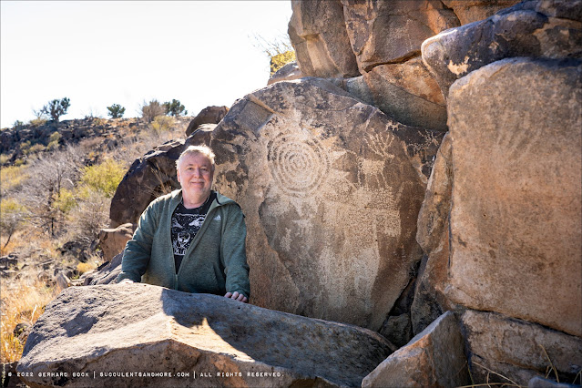 |
| Me next to an impressive panel showing a sun (?)... |
 |
| ...several deer... |
 |
| ...and a large shaman-type figure |
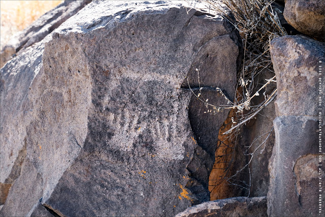 |
| Connected pair of hands |
More animals, typically ungulates like deer and antelopes:
 |
| Human and deer. They’re at eye level; what does it mean? |
The next three photos show a shield. Is it a heraldic symbol—a coat of arms, as it were—of a particular tribe?
And finally two photos showing modern-day graffiti. This doesn’t appear to be too much of an issue at the remote site we visited, but in more accessible locations it’s a big problem.
 |
| Notice the initials E.B. on the top right of the rock |
 |
| Airplane and initials |
A few more cactus photos before leaving:
 |
| Opuntia engelmannii |
 |
| Opuntia engelmannii |
 |
| Opuntia phaeacantha |
 |
| Cylindropuntia whipplei |
 |
| Cylindropuntia whipplei |
 |
| Cylindropuntia whipplei |
Before we called it a day and headed back to Phoenix, Ron took me to a population of Agave parryi that is out of place at an elevation of below 4000 ft. While variable, Agave parryi is a montane species typically found at 4500 ft or above; on Mount Lemon northeast of Tucson, there’s an Agave parryi population at 7000 ft.
Is this population of
Agave parryi simply an outlier? Or was it planted here a long time ago by the inhabitants of this mesa? Ron believes the latter is the case. He thinks
Agave parryi was brought here from somewhere else and cultivated as a source of
pulque, an alcoholic beverage made from the fermented sap of agaves that are close to flowering. In Central Mexico, pulque has been made for
at least two thousand years.
 |
| Agave parryi |
 |
| Agave parryi |
 |
| Agave parryi |
 |
| Agave parryi |
 |
| Agave parryi |
 |
| Agave parryi |
If want to learn more about the Perry Mesa Tradition,
this visitor guide from 1999 is a great resource. It also includes an appendix with drawings of petroglyphs found on the mesa.


Awe inspiring! I couldn't help but reflect on my broken ankle incident when we were out hiking and a few miles from the car and I had to "walk" back. Can you imagine if you had experienced something similar. Yikes.
ReplyDeleteI don't even want to think about it! The potential for injury *was* on my mind, especially as we were climbing around on those rocks, but I was being extra careful.
DeleteI remember how agile and fast you mentioned Ron Parker is! I did worry and was happy when you notified us all went so well!
DeleteWhat a great experience especially since you were with an expert who could provide background history on the petroglyphs. I find it interesting that no matter where you find petroglyphs in the world they all look very similar. We have some not far from where we live that could be included in those from the Perry Mesa and no one (but an expert) would be able to tell the difference. Suggestive of how civilizations moved throughout the continents.
ReplyDeleteIt's great that you had an expert like that to guide you. As I majored in anthropology as an undergrad, I find Agua Fria and its petroglyphs fascinating. I may never get to Machu Picchu but this site is closer to the possible category.
ReplyDeleteWhat an amazing and beautiful place. The metates are really interesting. Was the climate different in that area back when people lived there do you think? Looks too harsh for corn growing now. Or perhaps the dried grain was transported to that spot? And if so, why? Just pondering out loud…
ReplyDeleteHorticat
Very interesting article. Thanks for publishing it. Would you be able to pass on the contact e-mail for Ron Parker? thanks
ReplyDeleteYou can contact Ron through Agaveville.org. He is the administrator.
Delete